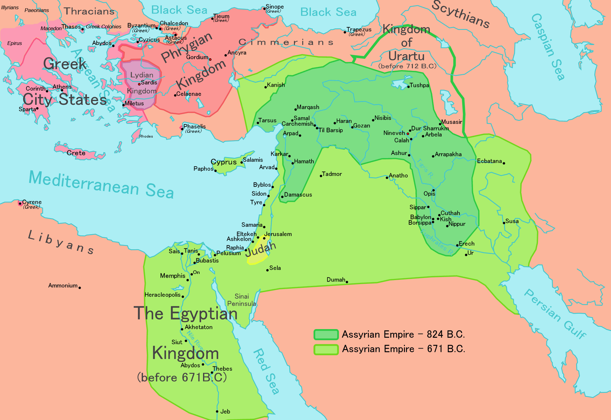
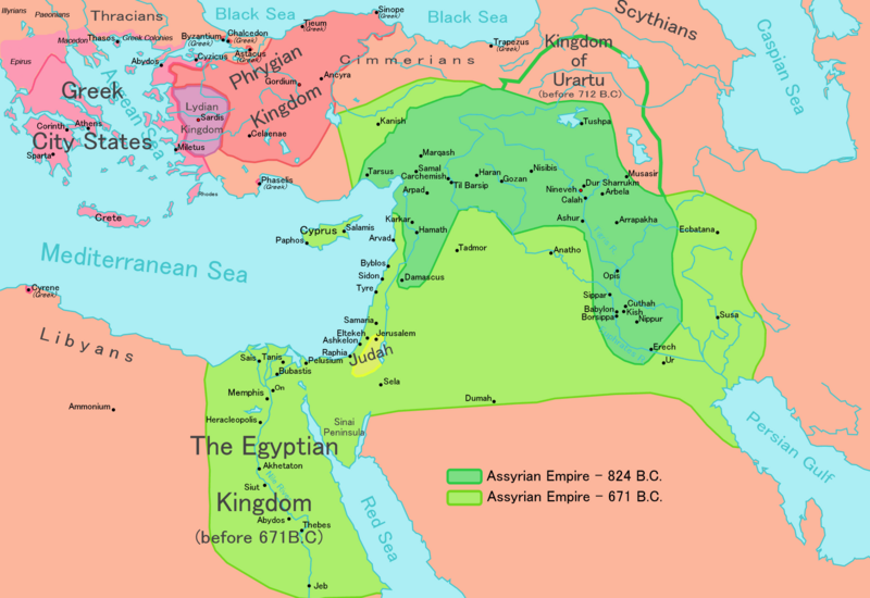
File:Map of Assyria.png
Jump to navigation
Jump to search
Size of this preview: 800 × 550 pixels. Other resolutions: 320 × 220 pixels | 640 × 440 pixels | 1,024 × 704 pixels | 1,280 × 880 pixels | 1,983 × 1,363 pixels.
Original file (1,983 × 1,363 pixels, file size: 160 KB, MIME type: image/png)
| Description |
[] English: Map of the Assyrian Empire Español: Extensión del Imperio Asirio Polski: Mapa Asyrii w 824 i 671 r. p.n.e. Português: Extensão do Império Assírio العربية : خارطة الإمبراطوريَّة الآشوريَّة. فارسی : نقشه امپراتوری آشور |
|||
| Date | ||||
| Source |
Own work data from
|
|||
| Author | Ningyou | |||
| Permission (Reusing this file) |
|
|||
| Other versions |
[]
|


File history
Click on a date/time to view the file as it appeared at that time.
| Date/Time | Thumbnail | Dimensions | User | Comment | |
|---|---|---|---|---|---|
| current | 14:32, 24 May 2018 | | 1,983 × 1,363 (160 KB) | wikimediacommons>Capmo | corrected typos in Trapezus and Hamath |
File usage
There are no pages that use this file.